
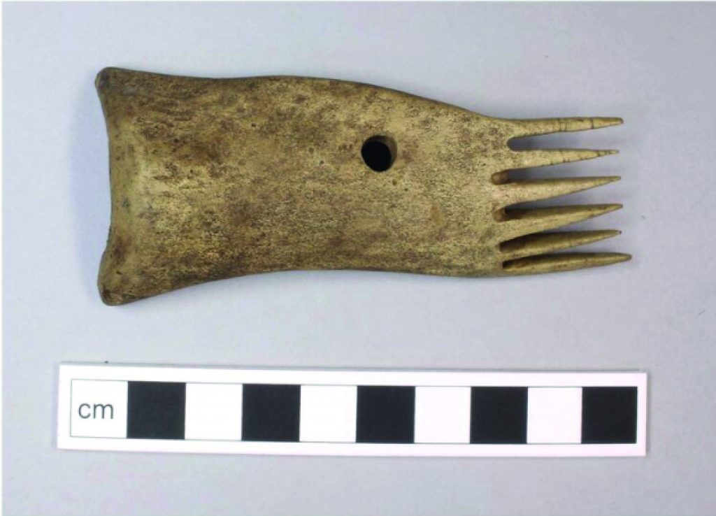
Sheep farming and the Lammermuirs go hand in hand; indeed, “Lammermuirs” may be derived from the Old English for “lambs’ moor”. People have been rearing stock here for millennia, ever since the first farmers arrived in the Neolithic period (c. 4000 BC-2500 BC). However, physical evidence for pastoral agriculture is hard to trace. Later prehistoric sites such as hillforts, of which there are numerous within the Lammermuirs, often display features such as enclosures which might be interpreted as being for the containment of cattle and sheep. However, it is very difficult to prove the function of these enclosures, and it is perhaps more worthwhile looking to the animal bone record for evidence of sheepfarming in prehistory. Broxmouth hillfort, just east of Dunbar, provides unusual evidence for the exploitation of sheep in prehistory. This hillfort was occupied in the Iron Age, from around 600 BC until the mid second/early third century AD. The animal bone evidence suggests that the fort’s inhabitants reared cattle, sheep and probably a smaller number of goats for both meat and dairying. The animal bone evidence in particular points towards sheep dairying, which is unusual in this period when dairy products were more commonly derived predominantly from cattle. The wool of older sheep was also used in textile production. Evidence of such craft activities at Broxmouth includes a spindle whorl for spinning yarn, long-handled antler combs used in weaving yarn into textiles (an example is shown to the right), and bone needles for sewing textiles into garments. Sheep, and their meat, milk and wool, were evidently significant to the economy of Broxmouth’s Iron Age community.
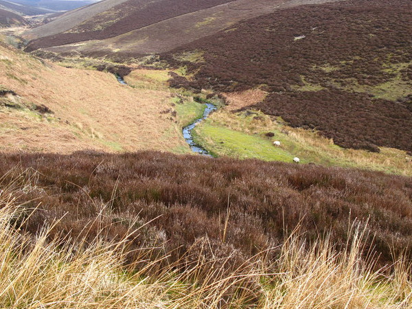
The early medieval period (around AD 300 to AD 900) has long been known as the Dark Ages because of the scarcity of evidence about life at this time; and early medieval sites are indeed thin on the ground in the Lammermuirs. However, one site that might date to this period is found at the confluence of the Dye Water and Kersons Cleugh (right). In 2011, excavation of two sub-rectangular structures yielded dates indicating a discrete period of occupation in the 7th to 10th centuries AD. A number of spindle whorls and loom weights were discovered, also datable to the early historic period. These are indicative of textile production, again highlighting the significance of sheep and their wool to the economies of the communities living in the Lammermuirs in the past. What’s more, the site lies within a block of land that was held by the monastery at Lindisfarne, significant here because the church became central to the production of wool during the medieval period.

Evidence for sheep farming becomes more apparent from the medieval period onwards. David I, King of Scotland from AD 1124-AD 1153, established over a dozen new monasteries during his reign and the Cistercian monasteries in particular (e.g. Melrose Abbey) and their associated granges (farms or estates associated with monasteries or other religious orders) resulted in enhanced agricultural production, partly through the introduction of monks, or lay-brothers, undertaking unpaid labour. Over time, southern Scotland and its monasteries became a key producer of wool for northern Europe. There are records of a handful of medieval monastic granges in the Lammermuirs. The only example still visible today is Penshiel Grange which was attached to Melrose Abbey, some 19 miles to the south-west as the crow flies. The ruinous buildings are believed to date to the early 15th century but Penshiel is mentioned in a charter dating to AD 1200.
Arable production in the medieval period is evidenced by the undulations produced by rig and furrow cultivation, but traces of sheep farming remain more elusive. Much of the evidence for pastoral farming will have been lost over time: wattle pens, for example, are not traceable in the landscape today. What’s more, cooling temperatures in the late 13th-14th century saw uplands farming communities like those in the Lammermuirs retreat to lower ground. Very little physical evidence remains for farming before around AD 1600. However, a possible sheepcote excavated in the Bothwell Water Valley as part of this project provides a glimpse of medieval sheep farming. A sheepcote is a building used to house sheep during the winter months; examples in England are known to have been associated with abbeys, and our example was perhaps attached to Kelso Abbey. You can read more about the archaeology of medieval sheepcotes here.
Evidence for farming families and communities after around AD 1600 is found in the abandoned farmsteads: clusters of homes and outbuildings that are scattered across the landscape. The Agricultural Improvements of the 18th and 19th centuries saw farming become larger scale and more industrialised, and many of the earlier farming communities were displaced and dispersed as sheep farming expanded in the hills.
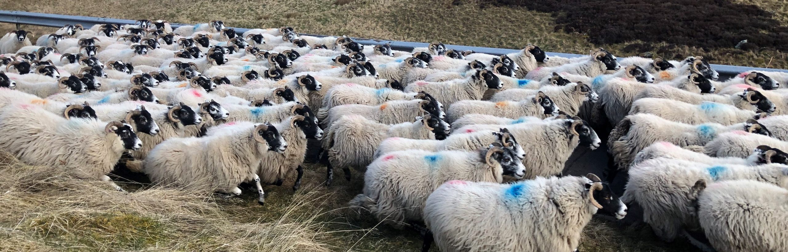
Evidence of this sheep farming is widespread in the drystone structures – sheepfolds, stells, enclosures and the like – that we find all over the Lammermuirs. As part of the Whiteadder project, landscape archaeologist Stratford Halliday undertook a comprehensive desk-based study of the sheepfolds in Berwickshire and East Lothian. He examined historic maps as well as scrutinising the LiDAR data and satellite imagery, and of course referring to any relevant archaeological fieldwork. This has revealed evidence for almost a thousand features, ranging from small pens at the edges of fields to large sorting pens that are still in use today, with almost 300 of them falling within the Whiteadder Project area . His initial aim was to integrate the distribution of small circular turf-built enclosures – known as ring enclosures – with circular stone stells, the latter being a characteristic feature of Border farming country. He had always assumed that turf ring enclosures had been replaced by drystone stells well before the mid-19th century but this research has shown that some of the turf ring enclosures had remained in use, appearing on the first large scale Ordnance Survey maps and only falling in decay in the late 19th century.. What has emerged from this research is a much more complex picture of a wide variety of features relating to sheep farming. The many and varying categories are shown at the bottom of this page. You explore a map showing all (almost) 300 of these features below!
Definitions
- Enclosure – an open enclosure, usually over 20m across.
- Fold – smaller enclosures, usually under 20m across, but not as small as the pens.
- Pen – small, often rectangular enclosures that are found mainly throughout the improved landscape, set against field boundaries or into the corners of fields, but also through the parks and plantations of country houses.
- Ring Enclosure – ring-banks of turf. These do not appear on any of the historic OS map series.
- Sheepfold – enclosures that contain one or two sub-divisions but do not appear to incorporate a race and other evidence of sorting pens.
- Sheepfold; Sorting –sheepfolds that are clearly designed for the management and sorting of flocks, often combining a large gathering pen with multiple smaller pens. Some almost certainly contain dips or washes.
- Sheephouse – these are narrow open-fronted buildings, which, where annotated on the maps, are arranged around the sides of enclosures. These are essentially lambing yards.
- Shelter – a length of wall or bank behind which sheep could shelter from the weather.
- Stell – reserved for the circular sheepfolds depicted on the 1st and 2nd editions of the OS County map series.
- Stell; Ring Enclosure – this has been adopted where a circular ring on the 1st edition OS 6-inch map is termed ‘Old’, including not only examples where a turf ring bank survives, but also where all trace of the ring has been removed.
- Wash – those folds annotated as sheep washes on the maps, and seems to range across small folds with several pens to little more than informal pools formed in streams. Quite how these functioned is unclear.
Historic Environment Scotland has a useful leaflet on farming in post-medieval Scotland here.