
This page presents a summary of the results of work at Bunkle Edge. You can read the full report here.
Introduction
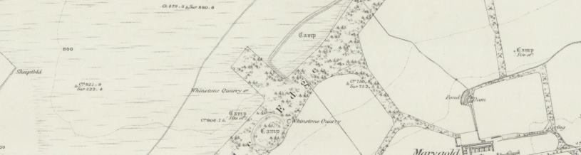
In January 2020, excavations were undertaken at the site of a possible prehistoric enclosure on Bunkle Edge. Now only traceable on the ground through dense forestry and bracken, the enclosures form annexes to the defended enclosures at Marygoldhill and Dogbush plantation. The function – and indeed the date – of these features is not known, and only limited investigations have taken place to date (Strong 1988).
Bunkle Edge is an 8km long ridge running broadly WSW-ENE between the Eye Water and Whiteadder. A series of prehistoric forts and earthworks are found along the summit of the ridge. Our work focussed on a sub-rectangular enclosure close to the Marygoldhill Plantation fort. Our excavations took place on the portion of the earthworks that lies within the Marygoldhill Plantation. The enclosure is visible on the ground as a linear depression which partially encloses the fort, running for approximately 200m SE-NE, turning at a right angle to extend around 425m SW-NE and around 85m NWSE. Entrances/breaks in the earthwork are suspected at its western end, on both the SE-NW and SW-NE stretches.
Excavations were carried out at the site in 1983, following severe plough damage. The enclosure ditch was found to be V-shaped and 5m wide, with a bank measuring around 3m in width on the interior. Excavations were halted at 3m in depth, which appears to have been close to the lowest point of the ditch. The enclosure was interpreted by its excavators as a defensive work annexed to the nearby fort (Strong 1988).
The previous excavations were useful in clarifying the form of the ditch but did not provide a conclusive date. The objectives of our excavations were to explore the nature and condition of the earthworks to gain a better understanding of the form, function and date of the ditch.
Excavations
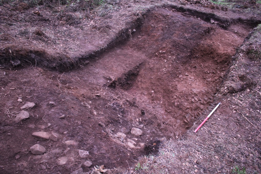
We excavated a single trench of 9m x 2.5m, aligned SW-NE across the ditch close to the northern edge of the plantation. An extension around 2m and 1.5m wide was later added to the south-west, to catch the back of the exterior bank.
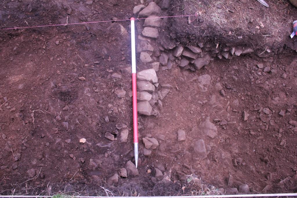
The banks were formed of a mixed stony deposit which survived to a depth of around 0.2m. the outer bank was around 2m wide; the full extent of the inner bank was not exposed. A line of stones was identified running along the back (exterior edge) of the outer bank. This survived as a fragmentary wall, surviving to one course of rounded and sub-angular stones up to 0.25m in diameter. This is interpreted as a facing wall or footing. Further stones interpreted as rubble from the collapse of wall suggest that the stone initially stood higher than one course.
Immediately beneath the overburden, a patchy mid orangey brown clayey silt overlay the bank material and slumped into the ditch. It was moderately compacted and stony, with some larger, rounded stones up to 0.3m in diameter, interpreted as rubble from the collapse of the bank.
The ditch was filled by a mid orangey brown clayey silt with frequent small sub-angular stones up to 0.05m in diameter. The fill was up to 0.4m in depth and appeared very sterile, with little to negligible organic content.
The rock-cut ditch was identified as V-shaped. The natural bedrock was soft and fragmented into small blocks, making the surface very irregular. It was overlain by a layer of clay, suggesting that it had been exposed to the weather for a considerable period.
Conclusions
Our work has advanced our understanding of the form of the ditch, which was cut into the bedrock, with the upcast material being incorporated into the banks. The previous excavators recorded that “on the steeper south-east side the fractured ends of the strata were covered with a smooth yellow clay” and interpreted this as having been undertaken by the ditch’s creators, “perhaps to exclude the possibility of footholds” (Strong 1988, 120; 123). Clay was identified during this most recent phase of work, covering the bedrock everywhere that it was exposed. While Strong’s interpretation is a possibility, our interpretation is that the clay formed naturally during weathering of the exposed bedrock while the ditch was open. Similarly, a layer of boulder clay was identified overlying the natural, directly beneath the outer bank material, suggesting that the bank was built directly onto the natural till which had been exposed during the digging of the ditch.
If the enclosure was rectangular, using the outlined denoted by Scottish Borders Council’s polygons and extrapolating to create a fairly regular rectangular shape which contains the nearby fort, the earthworks may have enclosed an area almost 100,000m2 or 10ha. A linear anomaly on the LiDAR data may indicate the line of the southern side of the enclosure, whether through a continuation of the rock-cut ditch or through the exploitation of the natural terraces created by the underlying geology, which is quite tabular in this area.
Unfortunately, our excavations have not enabled us to more accurately date the enclosure. No artefacts were discovered, and none of the soil samples collected during the excavations yielded organic material suitable for dating. However, our work did allow us to get a clearer idea of the form of the enclosure, revealing traces of a wall or footing running along the exterior of the bank, enhancing the picture of the numerous sites that are found along Bunkle Edge.