
Walkers’ cairns are found on almost every hilltop, a demonstration of presence and achievement: “we walked here, we made it to the top”. However, our landscape is scattered with cairns much older and much larger, constructed by the communities who lived, worked, and died there thousands of years ago. Prehistoric burial cairns take various forms and can date to the Neolithic (c. 4000 BC-2500 BC) or the Bronze Age (c. 2500 BC- 500 BC). These cairns are usually found to contain the remains of more than one person, interred in differing ways depending on the time period. There are 62 known or suspected burial cairns within the project area but very few of these have seen excavation. A previously unrecorded prehistoric burial cairn was identified in the LiDAR data and excavated as part of this project; you can read about this here.
In addition to walkers’ cairns and burial cairns, a third category of cairn exists: those created as a result of arable farming. Large stones are an inconvenience; they obstruct the plough so they are moved to the side of the field. We see evidence of this happening today, just as it did when the first farmers began cultivating the land in the Neolithic period.
Neolithic Cairns
In the Neolithic period, burial cairns featured internal chambers in which the remains of the dead were interred. Some of these cairns were round and others were long, with a tiered profile. Low doorways gave access to passageways leading to chambers which held the remains of the deceased: sometimes the bodies were placed inside while still articulated (i.e. complete), but often the remains were disarticulated. The bones were moved around or even removed and replaced according to custom, and through this interaction between the living and the dead, the deceased retained a presence and a place in their community. The practice of permanently burying individuals intact, in their own graves, emerged only at the end of the Neolithic period, representing a shift in thinking that saw the grave as the point at which the deceased became removed from society, both in place and in time.
Bronze Age Cairns
In the Bronze Age, cairns were mostly round and mound-like in appearance. They did not feature chambers. Instead, the deceased were either interred in the ground and the cairn constructed over the top, or cists – stone boxes – were inserted directly into the stones forming the cairn. Bronze Age cists are sometimes found inserted into Neolithic cairns, suggesting that it is the cairn that was significant to the community and their burial practices, rather than the act of construction of the cairn itself.
Mutiny Stones
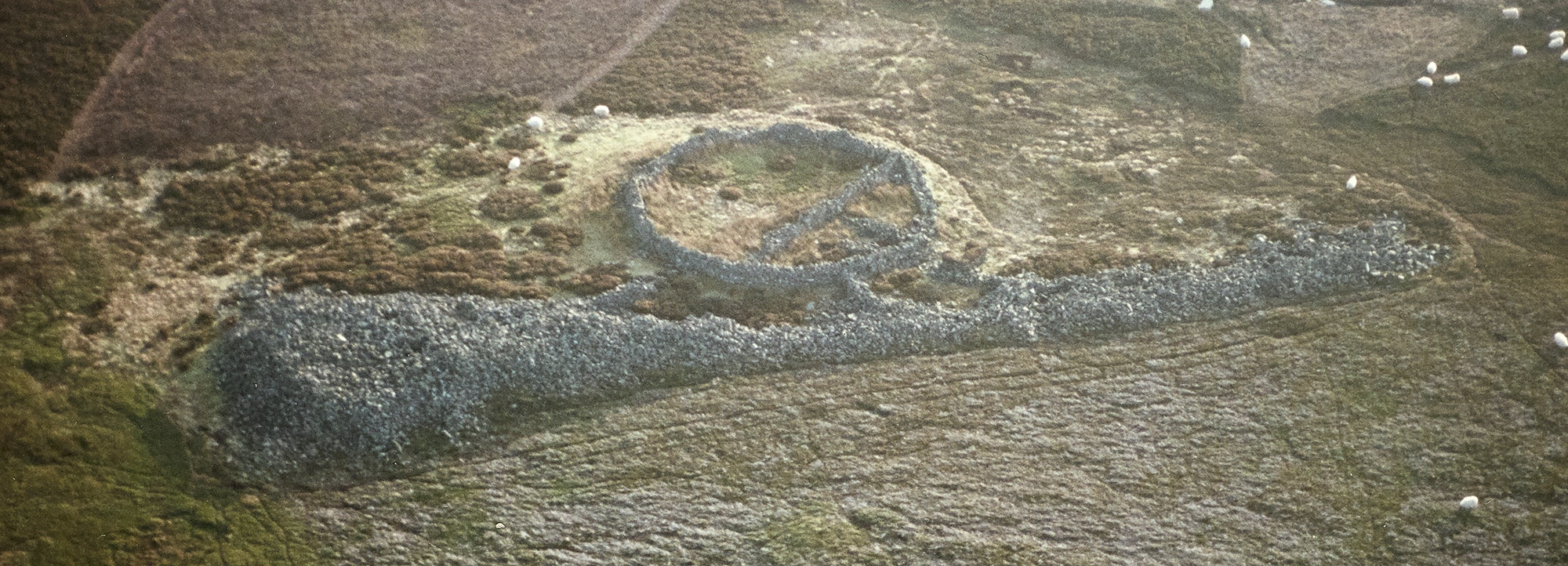
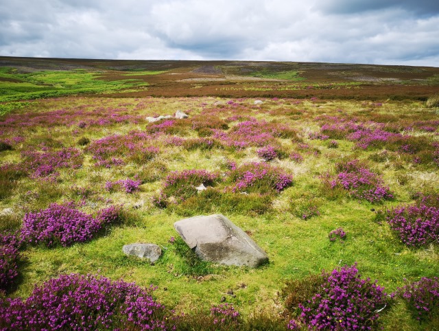
Perhaps the most impressive prehistoric cairn within the study area – and one of few to have seen any excavation – is the Mutiny Stones, situated high on moorland some 4.5 miles north-west of Longformacus. This Neolithic long cairn is over 85m long, and tapers from 23m in width at the east end to 7.6m at the west. It is a stunning example of this classic prehistoric monument type, and the only of its kind in south-east Scotland.
The origins of the name are unknown. The earliest reference to it is on Armstrong’s 1771 Map of the County of Berwick, where it is marked as ‘Mitten full of Stones’. It has also been called the ‘De’il’s Mitten’ and ‘Mittenfu’ Stanes’, perhaps in reference to a common legend that tells of the devil’s unsuccessful attempt to carry stones across a river in his mitten.
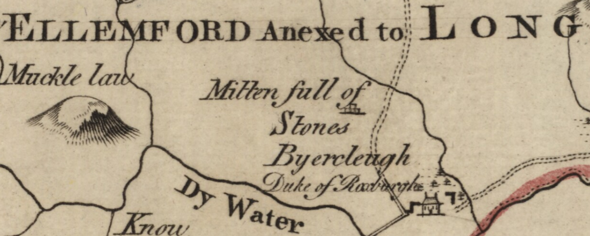
It is telling that the cairn is illustrated on Armstrong’s map of 1771 as a two-tiered structure (above). Like many long cairns, the Mutiny Stones survives today as a fairly ambiguous stone spread. Careful excavation of similar sites often reveals a stepped profile, disguised by the deterioration of the monument, with the highest stones tumbling down and hiding its true form. Armstong’s map suggests that the Mutiny Stones retained its stepped shape until at least the 1770s.
The site has been excavated twice: first in 1871, revealing “nothing of interest”; and again in 1924, when internal details suggestive of the division of space into chambers were discovered. On both occasions, the excavators suspected an earlier intrusion into the cairn, and indeed these monuments were often targeted in antiquity by treasure hunters hoping in vain to find treasure within.
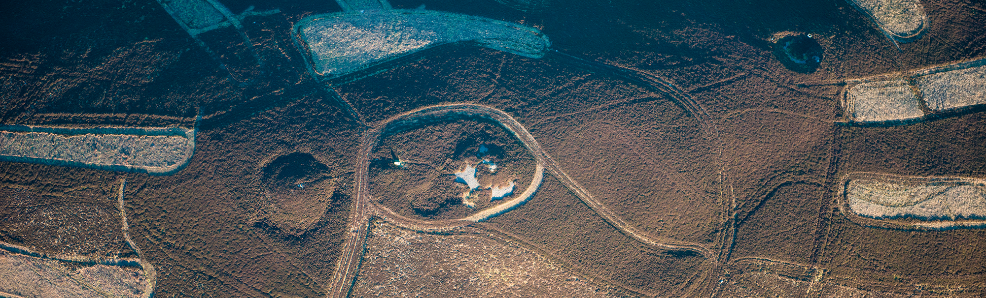
Dirrington Great Law
Three cairns are found on Dirrington Great Law, aligned in a row running broadly east-west across the summit. They are believed to be Bronze Age in date, and the westernmost cairn, at almost 2m in height and 20m in diameter with a ditch around the perimeter, is considered to be one of the most impressive cairns in the Scottish Borders.
Standing stones and stone settings
Ancient monoliths – standing stones – remain one of the most enigmatic prehistoric site types. They are among Britain’s most iconic landmarks, from Stonehenge in Wiltshire to Calanais on the Isle of Lewis. These are exceptional examples; monoliths on a truly monumental scale. Most standing stones, stone circles and stone settings (monoliths arranged in a non-circular plan) are more modest in scale, some protruding only a few inches above the turf. The purpose of standing stones is not well understood but they are thought to have had some ritual or spiritual significance. They typically date to the Neolithic (c. 4000 BC-2500 BC) or Bronze Age (c. 2500 BC-500 BC). and are thought to be a progression from an earlier tradition of creating circles of upright timbers; indeed, at some sites, timbers are known to have been directly replaced by stones. Our project study area might not boast any sites as well-known as Stonehenge or Calanais, but we do have more modest examples.
Stone Circles in the Lammermuirs
Yadlee Stone Circle consists of nine stones forming a low ring, with a further 17 stones scattered mostly to the south and west. This site formed part of a 2013 study by students at Edinburgh University, who noted intervisibility and possible alignments between this monument and others in the landscape: on the spring equinox at sunrise with Witches Cairn, and at sunset with Rook Law Cairn; and at sunset on the winter solstice with Spartleton Cairn. This means that, to someone standing at Yadlee stone circle on the given dates, the sun appears to rise or set from behind the other monuments. The equinox and solstice were likely important dates in the prehistoric agrarian calendar, marking a change in the seasons and a turning point in the year.
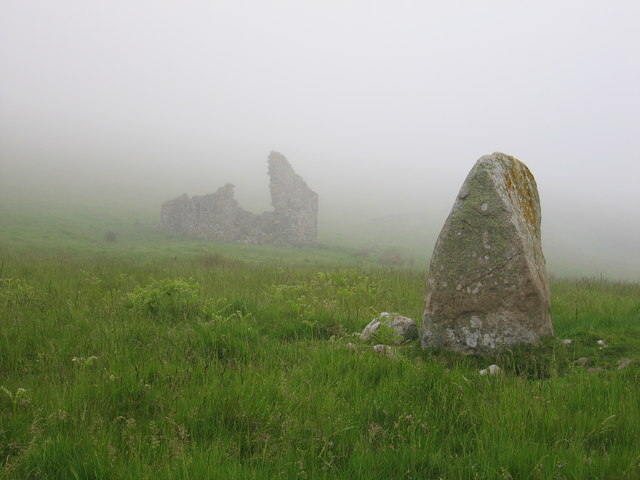
Close to medieval Penshiel Grange is a standing stone known as Chapel Stone, which may have formed a stone circle along with three smaller stones, perhaps set on edge or perhaps toppled from their original positions. There is a notable concentration of similar stone settings and small cairns in the area around Pensheil.
Rock Art
Between 6000 and 4000 years ago, in the Neolithic and early Bronze Age, people carved abstract designs into rocks: concentric circles, swirling lines, cup-shaped hollows and more. The Kell Stone is one of very few possible examples within the project area. It is found within the area to the north-west of the Whiteadder Reservoir, noted above as being liberally scattered with Neolithic and Bronze Age monuments. The Kell Stone features a number of sub-circular and circular depressions on it northern face, including two large circular indentations connected by a short groove to form a dumbell. The 3D model shown here was created as part of Scotland’s Rock Art Project. You will find lots more information about Scotland’s carved stone on the project website.